Posts

July 1 - Fire in Denali! July 1 update

Image
This is what we've been seeing and hearing all day: Lots of spot fires to put out. The Riley fire continues to burn in plain sight of all the lodges in The Canyon (aka Glitter Gulch), with cars, trucks, and RVs stopping along the only road through the area to snap pictures and check the progress of the fire. Electricity is cut off to The Canyon area as well, where Princess Lodge, McKinley Chalet (Holland America's lodge in Denali), and other businesses are in the dark.  No food to cook; no tours to give; this situation is creating problems for some businesses.  We are at the south end of the park and have not been affected by the electricity being cut off.  Flightseeing tours, white water rafting on the Nenana River, and dog sledding demonstrations (DogGoneIt Tours) outside Denali are operating.  (NPS dog sled demos are cancelled as Denali National Park is considered closed.)  The fire has grown to 385 acres.  Helicopters, using large buckets suspended by c...

June 30 - Fire in Denali! (and very visible to all)

Image
Big news...but not surprising news.  We have not had any appreciable rain while we've been here (since May 23rd), and today the worst thing happened - a forest fire erupted across the Nenana River from McKinley Chalet.  Here are some headlines and hyperlinks to read more about this fast moving fire: Smokejumpers, aircraft responding to fire in Denali National Park  - Alaska Wildland Fire Information Wildfire closes Denali National Park, prompts evacuations  - Fairbanks Daily News-Miner (This is the local paper and it still has a an entire page devoted to comics!  I miss that.) Crews fight rapidly growing wildfire near Denali National Park entrance  -  Anchorage Daily News Wildfire prompts evacuations near Denali National Park entrance along Parks Highway  - Alaska's News Source From the Park Service:  https://www.nps.gov/dena/blogs/riley-fire-updates.htm    I was running my regular shuttle run into Denali this morning when some...

June 19 - East Fork, as far as the road goes (for now)

Image
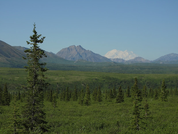
Denali National Park and Preserve is a HUGE park (over 6 million acres, 3rd largest in the National Park Service System) but has only one road going into the park.  The Park Road (yep, that's the name!) travels 92 miles to a remote, former mining area called Kantishna .  Mining ceased in 1985 when the area was incorporated into the national park. As I mentioned last week, a rock slide has closed the Park Road at Milepost 43, the East Fork of the Toklat River.  During the trip, Denali appears several times on the trip out... (75 miles away as the raven flies) ...but we can't see "The Mountain" from the East Fork River itself.  (Too low and the front range blocks the view.)  The South Peak (on the left) is Denali (Athabascan for "the high one") at 20,310' and the North Peak (on the right) is 19,470'.  (Sorry for all the parenthetical phrases.😉) So we hiked in the river bed.   This area is so big and we're so small.  What a great place for lunc...

June 12 - if it's Wednesday, it must be raining

Image
Well, this is our 3rd weekend off and the 3rd Wednesday that it's been raining.  Bound and determined to make the best of it, we rode the shuttle from Denali Park Village into Denali National Park, and rode one of the free shuttles into the park.  There is only one road into Denali; it goes 92 miles from the park entrance (on the right/east) to Kantishna (on the left/west). However a rock slide at Mile 43 (just before Polychrome Overlook at a place called Pretty Rocks) has closed the road beyond that point.  Per the NPS website, "t he rate of road movement within the landslide evolved from inches  per year  prior to 2014, to inches  per month  in 2017, inches  per week  in 2018, inches  per day  in 2019, and up to 0.65 inches  per hour  in 2021."  At this point, continuing to rebuild the road became problematic, so  NPS is building a bridge around the rock slide. And when we got to the Savage River turn around it...

June 5 - Moose, moose, and more moose - day off in Talkeetna

Image
Our days off this week took us to the funky little town of Talkeetna, Alaska.  Do you remember the TV show Northern Exposure?  Talkeetna is the basis for that quirky show.  Where else would you find a cat as mayor?  Talkeetna!  The first mayor, Mr. Stubbs, ran out of his 9 lives sometime after 2018 (when we worked in Alaska previously).  He was replaced by Denali a few years ago, followed by the current mayor, Aurora.  Susan is holding the mayor.  LOL!!  (Yea, that's a bear skin tacked to ceiling over Susan's head.)   And of course, if you have a cat for a mayor, there will be a dog driving the car. The paw-sibilities for canine humor are limitless.  Send me yours.  🐕😝 Talkeetna is Athabascan meaning "where the rivers meet."  And today, jet boats take tourists up and down the Susitna and Chulitna Rivers.  Talkeetna borough is located where the Talkeetna and Susitna Rivers meet.  Confused?  Me too!!...